HydraLink: Stormwater Hydrology & Hydraulics Modeling
A modern desktop application for rainfall-runoff modeling, hydrograph routing, detention pond design, and culvert and channel analysis — with two-way Civil 3D integration.
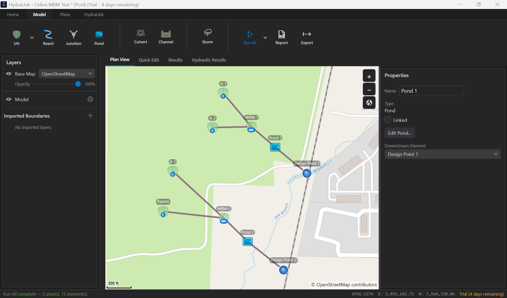
HydraLink covers the whole watershed analysis in one model: rainfall-runoff computation, hydrograph routing through reaches and ponds, detention sizing, and capacity checks for culverts and channels. Build the network on an interactive map, compare pre- and post-development plans side by side, and generate the report from the same project.
How It Works
From storm setup to a finished drainage report.
Define the storms
Import NOAA Atlas 14 depths, fit IDF curves, and choose SCS distributions, frequency storms, or a custom hyetograph.
Read the docs →Build the network
Place basins, reaches, junctions, ponds, culverts, and channels on the map, or import drainage areas from Civil 3D parcels and shapefiles.
Read the docs →Run and route
Compute runoff with the Rational, Modified Rational, or SCS Unit Hydrograph methods and route it through reaches and ponds.
Read the docs →Compare and report
Check pre- versus post-development plans, review hydrographs, and generate PDF and DOCX reports.
Read the docs →Detention Design
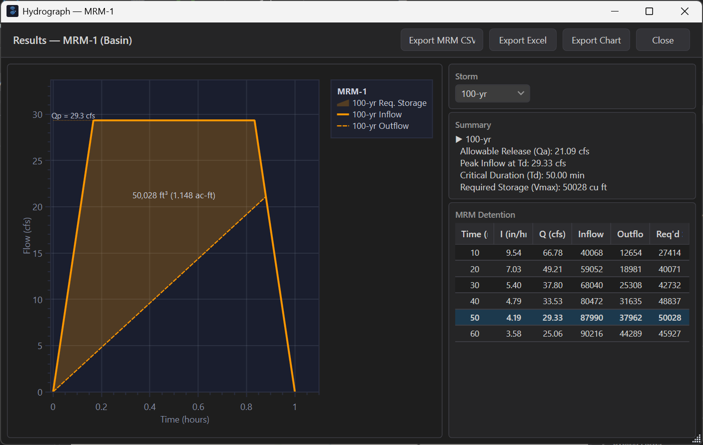
Size detention and retention facilities with Modified Rational Method required volume, then verify them with full Modified Puls routing through the stage-storage-discharge relationship. Compare the pre-development peak with the routed post-development outflow in the same plan.
- ✓Standard, iSWM, and Atlanta Regional Commission MRM approaches
- ✓Culvert, orifice, weir, riser, spillway, and restrictor plate outlets
- ✓Elevation-area or stage-storage pond definition
- ✓Worked example based on City of Celina, Texas guidelines
Hydrograph Routing
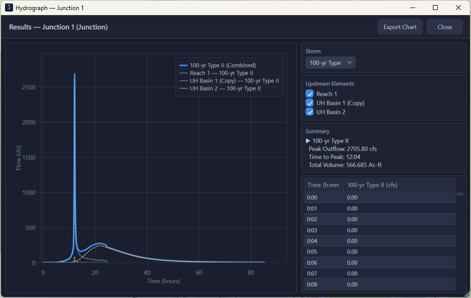
Generate full hydrographs with the SCS curvilinear unit hydrograph and route them through reaches with Muskingum-Cunge, Modified Puls, Lag, or Kinematic Wave methods. Reach cross-sections include trapezoidal, rectangular, triangular, circular, and 8-point shapes.
- ✓SCS Curve Number and Green-Ampt losses
- ✓TR-55 time of concentration calculator
- ✓Adjustable peak rate factor
- ✓Interactive hydrograph viewer at every element
Civil 3D Integration
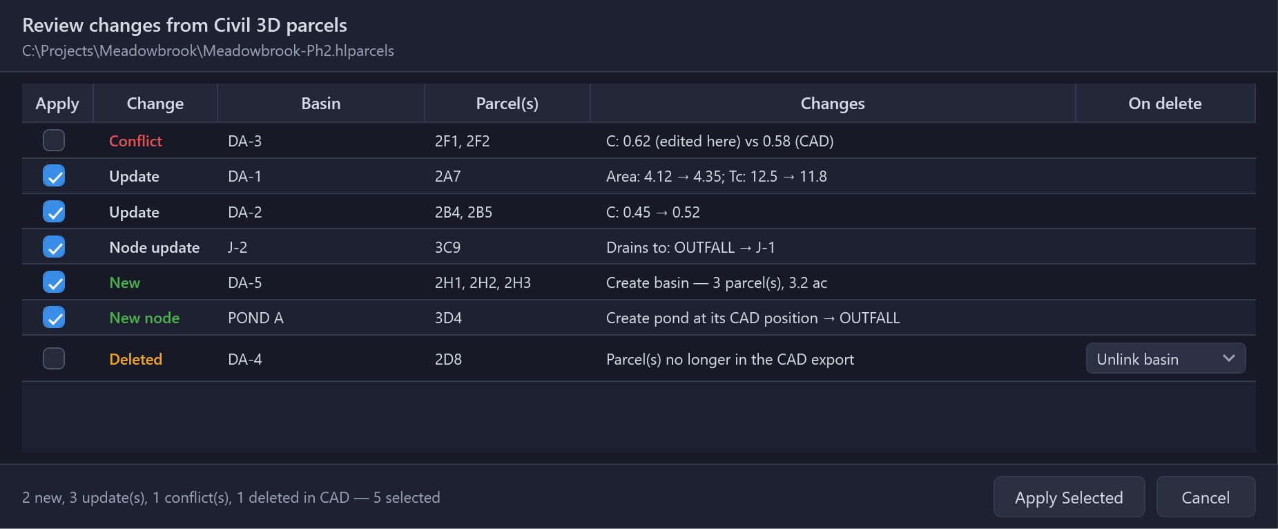
A companion add-in for Autodesk Civil 3D runs drainage calculations on parcels in the drawing and round-trips the model with HydraLink desktop. Drainage areas can also be imported from LandXML parcels and GIS shapefiles, so the model starts from the survey and design data you already have.
- ✓Live parcel calculator inside Civil 3D
- ✓Two-way sync between drawing and desktop model
- ✓LandXML and shapefile import
- ✓Results feed HydraStorm storm drain design
Capabilities
Everything documented in the HydraLink help, in one place.
Hydrologic Methods
Rational Method (Q = CiA) with weighted runoff coefficients, Modified Rational Method for detention volume, and the SCS unit hydrograph with Curve Number or Green-Ampt losses.
Learn more →Storms & Rainfall
NOAA Atlas 14 import with log-log or linear interpolation, IDF curve fitting (b, d, e coefficients), SCS Type I/IA/II/III, frequency storms, and custom distributions.
Learn more →Culverts
FHWA HDS-5 capacity analysis under inlet and outlet control, with road overtopping analysis.
Learn more →Plans & Scenarios
Compare pre- and post-development conditions or design alternatives, with linked elements shared across plans.
Learn more →Introductory Pricing
HydraLink is priced at its lowest point today. As major features ship — underground chamber detention, interconnected ponds, and deeper HydraStorm integration — pricing will increase to reflect the expanded capability. A 3-year license locks in today's rate for three years.
Every license includes all features, updates during the license term, and priority email support. See pricing for annual and 3-year options and multi-seat licenses.
System Requirements
- OS: Windows 10 or later (64-bit)
- RAM: 4 GB minimum, 8 GB recommended
- Disk: 250 MB free space
- Internet: Required for license activation and map tiles
Licensing
- Annual: $300 per seat
- 3-year: discounted, see pricing
- Trial: 7 days, no credit card
- Civil 3D add-in: optional, included
Frequently Asked Questions
Which hydrology methods does HydraLink support?
Rational Method, Modified Rational Method, and the SCS curvilinear unit hydrograph with an adjustable peak rate factor. Rainfall losses use SCS Curve Number or Green-Ampt, and time of concentration follows TR-55 sheet, shallow concentrated, and channel flow segments.
Can HydraLink size detention ponds?
Yes. It computes Modified Rational Method required volume and routes full hydrographs through ponds with Modified Puls stage-storage-discharge analysis. Outlet structures include culverts, orifices, weirs, risers, spillways, and restrictor plates.
Does HydraLink require Civil 3D?
No. HydraLink is a standalone Windows desktop application. An optional companion add-in for Autodesk Civil 3D runs drainage calculations on parcels in the drawing and syncs the model both ways; drainage areas can also be imported from LandXML parcels and GIS shapefiles.
Where does the rainfall data come from?
NOAA Atlas 14 data can be imported directly and fitted to IDF curves. HydraLink also includes SCS Type I, IA, II, and III distributions, frequency (alternating block) storms, custom distributions, and regional IDF tables for North-Central Texas iSWM counties and Georgia cities.
How does HydraLink work with HydraStorm?
HydraStorm, our Civil 3D storm drain design plugin, imports HydraLink basin and runoff results to drive pipe design flows. The two products are licensed separately.
Is there a free trial?
Yes. Every new account gets a 7-day free trial with full access to all features. No credit card is required.
Model Your Next Drainage Study in HydraLink
Try HydraLink free for 7 days. No credit card required.